
Sights
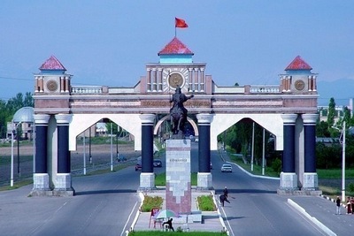
Bishkek
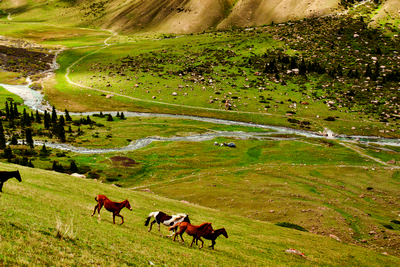
 The city is like a crown, surrounded by the foothills of the Tien-Shan Mountains. Greenery, though not as abundant as in the Soviet period, still surrounds the city with curly waves, and the windows of high-rise buildings offer beautiful views of the incredibly beautiful mountains.
History
Even in the 5th-6th century B.C. on the territory of Bishkek there were settlements of primitive people, but the makings of a future city appeared here thanks to the Great Silk Road. In the place of the city was a caravanserai of the Solto tribe, a native of which was the famous warrior Bishkek. In 7th to 12th centuries on the place of a modern capital resided a Djul settlement. Cities existed on this site till the very disappearance of the Silk Road and in the sixteenth century, and the area once again became the domain of nomads. During the reign of Kokand – in 1825 – by the order Madali Khan a fortress was built on the territory of the modern city. The fortress became the largest post-fort in Chui region, and the garrison located in the post-fort collected tribute from passing caravans. However, the Kyrgyz soon entered the Imperial Russia and the fortress was attacked more than once and conquered by the Russian troops. In 1862 the castle was destroyed, and Cossack picket with bazaar was based at its location. Later, in 1868 the village Pishpek was based on the site of the fortress and the status of city was given to this geographical point 10 years later on April 29, 1878. History was moving irresistibly forward, and the tsarist regime collapsed and Bolsheviks and Socialists came to Kyrgyzstan. In April 24, 1924 the Czechoslovak society “Intergelpo” arrived in Pishpek and began to build the new Soviet city. The city first became the administrative center of the Kara-Kirghiz Autonomous Region, and then the center of the Kirghiz Autonomous Region, and finally in 1936 it became the capital of the Kirghiz SSR. By this time, the city had been renamed in honor of the city’s native Soviet military leader Mikhail Frunze. His house became a museum and now, in one of the most important museums of the capital, everyone can see how young Mikhail Frunze lived. The name Frunze was very appropriate for the capital, not only because of the character of the prototype, but because the word “Frunze” is translated from Romanian as “green”, and because the city has incredible greenery, which is like beauty curls framing the face of the city. In February 1, 1991 by the decision of the Supreme Council of the Kirghiz SSR, the city was renamed to Bishkek again and Kirgizia became the independent country of Kyrgyzstan.
Walk around the city
 The city has grown signifcantly in upwards and outwards directions. Places that once seemed outskirts of the city became suburbs, located not far from the city center. And the concept of “Downtown” is now much more extensive. Bishkek is one of the few cities of the former Soviet Union which is not trying to erase the traces of the Soviet Union.
The house of Mikhail Frunze still stands peacefully in the museum; the city is full of blocks from the Soviet architecture that haven’t been diluted with modern high-rise buildings. In its center, although not in the main square, but in one of the parks, there is Lenin monument, which is a popular place for tourists, who consider it their duty to be photographed with possibly the last Lenin monument still standing in post-Soviet capitals.
Parks
 Parks, as the green decoration of the city, deserve a separate story. One unique park is the Karagach Grove, which in the past was a huge area full of rare species of trees that were brought to Bishkek from all over the world. The park was laid out in a swampy area in 1881 at the initiative of Fetisov. In a grove there are more than 50 species of trees and shrubs, where the numerous birds nest and two lakes, Komsomol and Pioneer, are located.
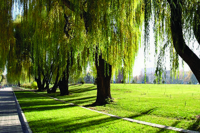
The city is rich in parks and botanical gardens, tempting with green foliage. Bishkek seems extremely green for those who are used to the concrete jungle.
Architecture
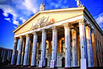 International hotels, world-famous brands and corporations came to the city and are establishing new original buildings. Construction of residential blocks also ceased to be the act of copying identical concrete boxes. People are spoiled with urbanization and expecting beautiful architecture, and therefore really elegant structures keep emerging in the city. Neighborhoods of Bishkek will take you into the past with familiar suburb areas, full of “Khrushev” and “Stalin” type houses that are fundamental structure of the Soviet era, as well as mosaic-covered fountains and mosaic paintings that adorn the walls of high-rises of a bygone era.
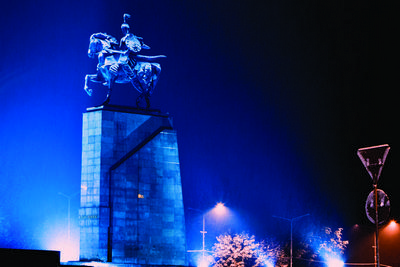
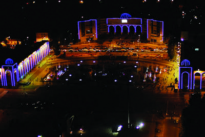
Characteristic features of the capital are its squares that include Victory Square, Old Square, Soviet Square and the most famous Ala-Too Square, which is located near the building where the President and Parliament work. Major holidays are held in this area, but it is also notoriously known for rallies.
The rallies that took place in 2005 and 2010 turned into coup d’etat, the result of which was liquidation of clan politics and patronage system. A monument is erected in the square in the memory of those who died so that future generations do not forget about this sad date.
Bazaars
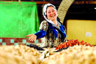 Foreigners like to visit the bazaars of Bishkek such as the Osh bazaar, which beckonsthem with unimaginable oriental flavor and the Dordoi bazaar, which has its own infrastructure and is the largest market in all of Central Asia. This bazaar makes a significant contribution to the economy of Kyrgyzstan and provides thousands of people with working places.
Archaeology
 The Chui region is full of mysteries. This territory was inhabited almost from the Stone Age and therefore it is not uncommon to find treasure here. Generally, archaeological finds such as bronze, silver and gold coins, the remains of homes, pots, arrowheads and more in the Chui valley date from the early Middle Ages until the thirteenth century. In the 70s a 30-kilogram treasure full of Karakhanid dirhams was found in the village of Krasnaya Rechka. In the 80s coins dating back to the fourteenth century, the time of the reign of Chagatai, were found in the same place.
Many archaeological treasures can be found near Burana, near the city of Tokmok. The land around Burana is full of mounds, but unfortunately, 99 out of 100 have already looted. There is a very interesting settlement near Bishkek called Karadzhigach, in the past Tarsakent, “the city of infadels”, where Christians lived. More than 600 gravestones with Christian symbolism have been found there. The city was destroyed by Amir Timur (Tamerlane).
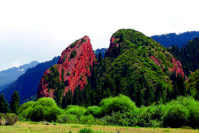
Ala-Archa
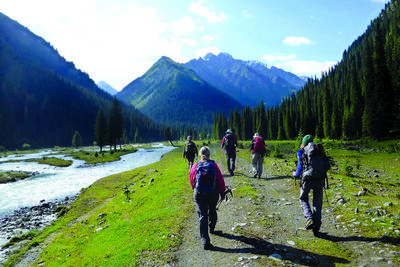
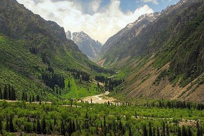 Ala-Archa is a natural park very close to the capital at a distance of 41 kilometers, and for sure one of the favorite places of Bishkek residents for hiking and picnics. The park still has untouched flora, which is particularly striking for tourists who are unaccustomed to see a national park in such close proximity to the city. More than 70 species of trees and shrubs and 50 species of medicinal plants grow in the park. In addition, variety of animals, including the endangered animals such as argali, deers, goats, pigs, rabbits and foxes, lynx and golden eagles, snow leopards and vultures live there. There is a Baitik village not far from the park, named after the national hero, Baitik, who was buried in the village.
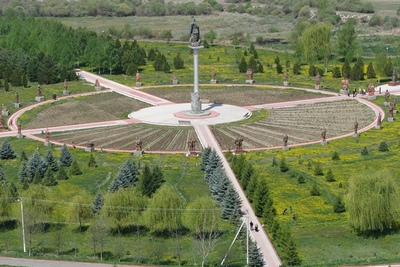
Ata-Beyit
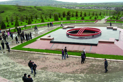 A lot of people knew the fact that the leaders of the Kyrgyz intellectuals were repressed, but the place of their burial was not known for many years. More precisely, only one casual witness and participants of the massacre knew about the place. The witness held it secret until his death and only on his deathbed he told everything to his daughter, who was too afraid to tell the truth for a long time. But she did. The remains of leaders of the Kyrgyz intellectuals, representatives of different nations and religions were found in brick kilns. The skeletons of 137 people, together with the documents were found in the space of 4x4 meters. However, these were not all the remains, because in the Soviet Kyrgyzstan tens of thousands of people were persecuted. The remains of many of them have been found much later, not far from the first burial site. By that time, the memorial Ata-Beyit complex was built, in which the remains of the repressed were buried. Among those repressed were such luminaries of Kyrgyz culture and politics as Kasym Tynystanov, Bayaly Isakeev, Yusup Abdrakhmanov, and Torokul Aitmatov, the father of the legendary Kyrgyz writer Chingiz Aitmatov. The writer himself was also buried in the memorial complex in 2008.
Tashtar-ata
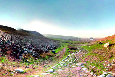 Most of the sights of Kyrgyzstan are valuable as historical objects. But there is Tashtar-Ata, a mountain of salvation, which despite of being ancient, remains modern. Tashtar-Ata is located in the foothills of Bishkek. Once Alexander the Great and Amir Timur passed through this mountain. The hermits prayed here first, and then the Muslims. This place seems to be charged with energy. According to legend, Tashtar- Ata was a great hero, who fought with the enemies for 40 days and nights, and when he decided to take a break he turned into a stone. Since then, people began to bring stones here, as a symbol of endured hardship, and the man-made mound was formed in this place. Now mound is used for psychotherapeutic purposes, and people who suffer from addictions come here. The psychologists from the Nazaraliev Center (a world-renowned narcologist) carry out rituals and therapeutic sessions with addicts. The place, which has been the home for prayers for centuries, has a lasting impression on people with addictions.
Talas
 Talas is located in the valley of the River Talas and is the administrative center of Talas region. Officially the city appeared only in 1877, when Russian and Ukrainian immigrants settled on the left bank of the river. However, before that ancient Turkic settlements were in the Talas area. Back then, the city Atlah was situated in the Talas region. Talas is known in the history as the place of the Talas battle, the battle between the Arabs and the Chinese, which took place in 751. The combined forces of the Arabs and the Turkish resisted the Chinese. The armies stood facing each other for four days, not daring to start the fight until the Karluk troops struck the rear of the Chinese. The Chinese army was forced to retreat, but the Arabs were not able to stay on the territory either. Soviet and Central Asian scientists call this battle the clash between two great civilizations, and the consequence of the battle was the Islamization of Turkish population. In addition, paper production was started in the West through the held Chinese and several states underwent incredible changes. The Tang Empire of China suspended its spread westward for almost 1,000 years, the Karluks set up an independent state, while the Uighurs were able to restore their own state in East Turkestan, all because of this battle.
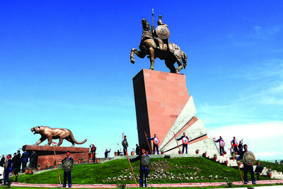
Manas Mausoluem
 Manas is the main hero of Kyrgyz people. The epic poem “Manas”, which is considered the longest in the world, was dedicated to this hero and characterized by Chingiz Aitmatov as an “ccean-like epos”. The scope of this epic poem (500 553 lines) exceeded the largest epics of world nations. For example, the version of Sayakbay Karalayev is 20 times longer than ancient Greece epics “The Iliad” and “Odyssey” together, and 5 times longer thant the Persian “Shahname”, and 2.5 times longer than the Indian “Mahabharata” and “Ramayana”. For the residents of Kyrgyzstan epic poem consists of three parts – the saga of Manas, his son Semetei and grandson Seytek, the greatest Kyrgyz heroes. However for Kyrgyz people who once migrated to China and now live there, the epic poem is even longer and consists of seven books, that is, the book of Manas and his six offspring.
Manas, like none other, characterizes the favorable attitude of the Kyrgyz people towards other nations. His wife was the Princess of Bukhara and his best friend was the Chinese Almambet. Manas is a non-fictional character, and most likely is based on a real person: Barsbek, the great ruler of the Kyrgyz people. He defended the independence of his people and became a person whom other rulers, even China’s rulers, regarded. Moreover, Manas’s Chinese best friend Almambet bears a striking resemblance to the ancient Chinese military leader Li Lin, who once was appointed as Kyrgyz governor, but as he became very friendly with the people, he began to assert for independence of the Kyrgyz people.
Manas is honored more than anyone else in the country and even proposals to rename the capital to the city of Manas have been introduced in Parliament. This was despite the fact that in Bishkek the name of Manas was given to an avenue, airport, university, and central squares in many cities adorn his statue. Talas is the birthplace of the hero, here is his tomb, a place revered by Kyrgyz as a Manas Mausoleum.
Similar to Talas, Naryn is also situated by the river and was named in honor of the river. The river originates in the mountain valleys and gorges of Issyk-Kul and Naryn regions and runs through Naryn, Jalal-Abad and Issyk-Kul regions and merges with the Kara Darya and forms the Syr Darya River.
Naryn
 Due to the proximity of the city of Naryn to the Chinese border (200 km), it is called the access to the gate of China. In addition, Naryn is coldest city in Kyrgyzstan, where winter lasts 145-165 days.
The main territory of the Naryn region is made up of ridges, interspersed with forests, deserts and lakes. The city of Naryn is the starting point for many different tourist routes.
The city of Naryn was built on the trade route leading to Kashgar, but its official birth is attributed to 1868, when the Russian military garrison site was established there. In the center of the city stands the memorial, a tribute to an armed clash in 1920 between the Bolsheviks and the White Guards.
Tash-Rabat
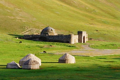 Near the border of Kyrgyzstan with China, on the way from At-Bashy to Aksai, there is an ancient caravanserai called Tash-Rabat. This is perhaps the most well preserved building of that time, entering which you are immediately transported to many centuries ago. The caravanserai was built in the fifteenth century. Trading caravans from different countries were constantly passing through this Caravanserai. Tash Rabat remained its value till the ninteenth century. The caravanserai was built of stone blocks by the architect masters who significantly contributed to its construction. It has several domes, guest rooms of the eastern Muslim type; the central hall and a large spacious hallway. Moreover, it has 40 rooms.
Tash Rabat is located in a picturesque valley of Kara-Koyun in Naryn region and is one of the most important archaeological sites of Kyrgyzstan.
Son-Kul
 Naryn region differs with its incredible natural beauty, virtually untouched by man. Numerous lakes and rivers decorate this area like the shine of thousands of diamonds, and the main sparkling stone in the crown is the Son Kul lake.
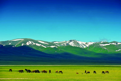
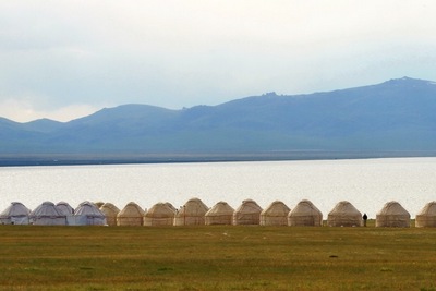
Son-Kul is a large alpine lake and is located in a conservation area. The nearest inhabited place is a city of Chaek. The lake is a perfect place to rest for people tired of civilization. The lake is known for its clean air, crystal clear water and an incredible amount of fish and birds that dwell in the lake. In contrast to Issyk-Kul, whose main feature is that it never freezes, Son-Kul lake is covered with ice from September to June. Further, there were no fish in the lake until they were specifically introduced. Tourists can stay in a nomadic yurt and can experience firsthand living far away from civilization, admire the starriest sky in the world and surface of the lake flat like glass, and eat organic and tasty Kyrgyz cuisine.
Koshoy-Korgon
 The hillfort Koshoy-Korgon is located 12 km from the village of At-Bashi and represents the ruins of a fortress that stood in the fifth through seventh centuries, on the way of trade caravans. According to legend, this place is associated with the name of Koshoy, who was the uncle of the main Kyrgyz hero Manas. He was the one who built a citadel to save people from the devastating attacks of the Chinese. Over the years the fortress was impregnable until Koshoy was killed by treacherous cohorts.
Chatyr-Kul
 Chatyr-Kul, the “Heavenly Lake”, is located between the ridges of At-Bashi and Torugart-Too. Around 17 rivers flow into this closed lake, and although the lake is considered fishless, there are some fishes. Along with the abundance of fish, the lake is a home to a number of wild and rare birds – such as Indian geese listed in the Red Book. The shores of the lake are covered with magnificent relic forest, consisting of the Tien-Shan blue spruce, Turkestan juniper, sea buckthorn, ephedra and many medicinal herbs. The same forest and the mountains are full of a variety of animals ranging from leopards, foxes and wolves, to argali and red marmots.
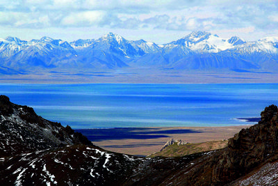
Issyk-Kul
 Issyk-Kul is the largest lake in Kyrgyzstan and is one of the largest and deepest lakes of the world. Issyk-Kul is an absolutely unique place due to its climate. It is both marine and alpine, which gives an excellent opportunity for athletes to train. In such circumstances, athletes can show outstanding results.
Issyk-Kul is full of mysteries and legends. The main legend is about the ruins of the city Chigu that rests on the bottom of the lake. On August 8, 2014 another confirmation about new artifacts from the legendary capital of Usuns were found.
According to another legend, a city is not the only thing hidden on the bottom of the lake. In the northern shores of the lake under the water surface rests an old Armenian monastery in which the relics of St. Matthew are buried. At least, the Catalan world map from 1375 says so.
The shore of Kyrgyz pearl is not only full of mysteries, but also historical artifacts. A pass called Santash, “Counting stones”, can be called as one of these objects. According to a legend, Tamerlane passed through this area while going to the next campaign against the nomads. He ordered each of his soldiers to take one stone and put it in a pile, and thus a huge mountain emerged. Coming back, he ordered them to repeat the process and saw that the second mountain is much smaller than first. Since then, this pass through which Tamerlane’s troops passed is called Santash, and counting stones are there to this day.
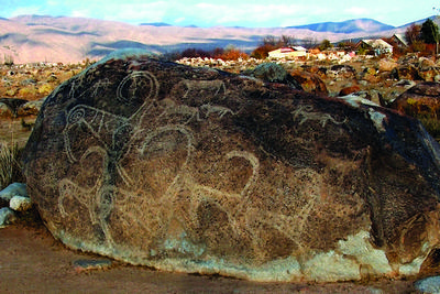
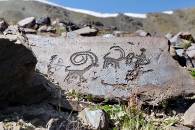
Museum of Petroglyphs
 Another unique open-air monument is the museum of petroglyphs, located near the city of Cholpon-Ata. Enthusiastic tour guides will gladly tell you everything about stones with paintings and carvings stored under the open air there, and in which century these mysterious letters were inscribed.
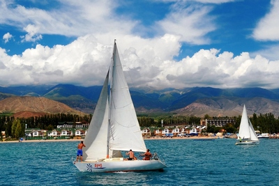
Usually people coming to rest at Issyk-Kul are engaged in vacation tourism, which is simply lying on the beach. Issyk-Kul region also gives the opportunity to take part in eco-tourism, as well as historical, national and extreme tourism.
Inylchek
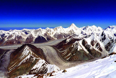 One place that is neither far from the beach nor too far to the top is Inylchek Peak. It is a mountain ridge in Central Tien Shan of 5,697 meters high, the glacier of which is full of lakes and steep slopes. On its spine there is a climbing base “Youzhnyi Inylchek” at the height of 4000 meters above sea level. The base serves as a starting point for for an ascension to the peaks of Khan Tengri and Pobeda Peak, as well as the end point for tourists who started the journey in Dzhergalane, At-Zhailoo and Echkilitash.
Ecotourism
 In addition to the places described above, there is a set of many other gorges well known for the nature, lakes and forests – practically any of the resorts offer excursions to interesting places to break up a beach holiday. Enjoy a horse ride in protected areas, practice falconry in one of the gorges, fishing in the most favorable parts of the lake or diving in one of the deepest lakes in the world – an underwater journey through the expanses of a concealed sunken city.
Skazka
Imagine yourself a conqueror of Mars in the gorge called “Skazka” – a place with truly Martian landscapes. This gorge is on the southern coast of the lake at the village Tosor, in 4 kilometers from the main route. Nature, playing with sand as with plasticine, created the surprising clay city full of incredible and fantastic silhouettes. Perfect scenery for a science fiction movie.
Sacred Lotus
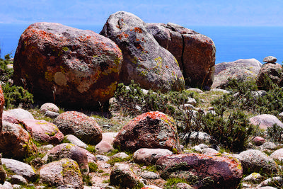
 «Om mani padme hum» – is inscribed on one of the boulders of Tamga gorge, on the southern shore, which means “God be sacred lotus flower”. It is a Tibetan prayer, and writings themselves, which are inscribed on it and two other rocks of the gorge, are dated back to the eighth and ninth centuries. This is a legacy of the Buddhists, who lived here in the early Middle Ages. Stones are revered by Buddhists as sacred, and pilgrimage are regularly made to the gorge.
Walk on Water
To walk on water like a saint is possible if you are a saint, or if you are in lake Tuz-Kul (also it known as Kara-Kul or the Dead Lake). The lakeis situated on the southern shore of Issyk-Kul, 73 kilometers from Balykchi. The salinity of the lake varies according to the season, but it is equal to the salinity of the Dead Sea. Due to the density of water in the lake it is impossible to sink, and the concentration of salt helps to cure many diseases, such as psoriasis. Silt mud from the bottom of the lake is also used for medical purposes: black for the treatment of the musculoskeletal system, blue – for cosmetic purposes, green – for gynecology.
The Legend of Issyk-Kul
 There are plenty of myths and legends about the origin of this unique lake, and the best of them are poetic and even tragic, like the best works of the Middle Ages. According to the first legend, on the site of the lake was the city in which lived a cruel and capricious ruler. He saw a beautiful girl, daughter of a poor nomad, and he desired her. He sent her matchmakers with gifts, but she rejected him. Then she was simply kidnapped and brought to the palace of the governor. The ruler began to cajole her again, but proud girl did not want to be the wife of the old Khan, and he decided to take her by force. To save herself from a shame, the girl rushed from a window of the high palace. Walls trembled, the earth shuddered, water from everywhere rushed and flooded not only the royal palace, but also the whole valley. On the place of the city, the lake, pure as crystal, was formed, and in serene summer days you can see the ruins of the castle and hear the girl’s voice.
An ancient beautiful city exists in every legend of the Issyk-Kul, because it really existed. Another epic about this lake is very similar to the real opinions of scientists about its origin: because of the strong earthquake ground sank, and the city became submerged.
According to the legend a group of girls on the eve of the earthquake came from the city to collect firewood. By the time they returned, the city ceased to exist. Sitting on the shore of newfound lake girls began to mourn their loved ones, which is why crystal mountain water regained its salty taste.
Eagle and The Olive Branch
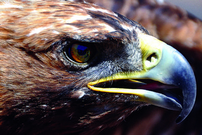 With a personal legend was honored a Russian traveler and explorer Nikolay Mikhailovich Przhevalsky. He was a great admirer of Issyk-Kul, having seen it once, he was even buried here. Once, local shepherds complained to him about an eagle of enormous size that attacked the flocks of sheep. Many times he tried to track down and kill the eagle, but it was flying too high to be shot. Once the traveler got sick and stayed in his tent and was able to see firsthand the existence of the mythical eagle. Despite the weakness Przhevalsky fired a gun into an eagle and a bird fell at his feet. Since then, the shepherds grazed their cattles without fear, and after the death of the traveler, on his grave was put an eagle with an olive branch in its beak – the eagle in a tribute, and branch as a symbol of peace and happiness of human.
Jeti-Оguz
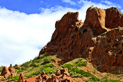
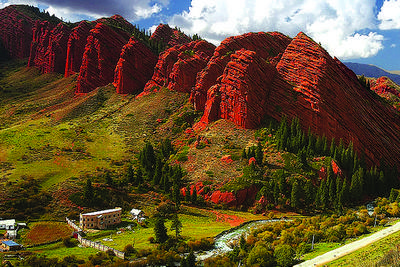 The emergence of the mountains, with a silhouette similar to a herd of bulls, and the valley in which they are located, is also associated with a legend. In ancient times, there were two clans living in this region, and the head of each was a cunning ruler. One of them kidnapped the wife of the other, and started a feud between the clans. War had to be stopped, but the governor did not want to give back the woman. Then his viziers advised to kill her, and to give the spouse her corpse: after all he had only asked to return the spouse. She will be returned, the requirement will be executed, but he cannot use her. The khan agreed. To carry out the idea he decided to hold large funeral. A lot of people came to the wake, and seven huge red bulls were slaughtered for the preparation of funeral meals. When the seventh bull was stabbed, the ruler killed the woman: her blood splattered on the mountain, so that even now scarlet spots are visible on the cliffs. Along with her blood, gushing boiling water flooded the whole clan of villain Khan and took far away the seven red bulls, and the valley and the mountains are given memorable name – Seven Bulls – Jeti Oguz.
Broken Heart
 Legends of cruel governors of Kyrgyz are common. The same is in the legend about the emergence of a mountain in the form of a broken heart, the main villain of which is the steppe ruler. So once, there lived on this blessed territory an old Khan, the owner of a large harem. Being aged man, he saw the girl, lovely as the sun, and decided to own her by any means. The belle was born in a poor family and was already engaged to a young beloved man. Learning about the desire of the khan, the lovers decided to flee to the mountains, but the governor sent men who killed the young man, so the girl decided to return the Khan. When she was transported through the pass, her heart it did not endure and she died. Since then the mountain in that place is similar to a broken heart, which bleeds.
The Village of Barskoon
 Near the modern village of Barskoon there was the fortress city, Barskhan, in the Middle Ages. Probably, the toponym of “Barskhan” is connected with the tribal name Barskhan, as together with other related Turkic tribes and clans lived a tribe in the Issyk-kul basin during the early Middle Ages. Sebuk-Tegin, one of the founders of the Turkic states of the Ghaznavids in Afghanistan in the twentieth century, was from this tribe. In the twentieth and twenty-first centuries, the city of Barskhan was the governor’s rate of separate possession in Qarakhanid state. The father of an outstanding scientist-turcologist Mahmoud of Kashgar (Barskhani) was the deputy of Qarahanid’s khagan on this earth, and the future scientist-turcologist was born and grew up in this city. Due to changes in the political situation, strengthening of civil strife (as a result of which his father, Huseyin, was killed) Mahmoud moved to Kashgar. Parents of the great scientist came from the ruling dynasty of Qarakhanid. Barskhan City existed until the Mongol invasion.
Osh
 Osh is the southern capital of Kyrgyzstan and perhaps the oldest city in the country. Its history and its age are vast, as it is more than 3000 years old, which was celebrated at the international level in 2000. The city is located on fertile lands and is considered one of the Islamic religious centers of Central Asia. Its main attractions include many old mosques and the sacred mountain Suleiman Too.
According to history, the Kyrgyz migrated from their historic homeland, the Yenisei, and settled in the foothill oasis where Osh is situated about 500 years ago. Legends about the Yenisei can still be heard in the Kyrgyz legends, epic poesm and tales. The earliest mention of the Osh city comes from the ninth century. Osh, like Bishkek, was the point of intersection of trade routes in the past the great Silk Road passed through Osh.
In 1868, following the northern cities of Kyrgyzstan, Osh also became the part of the Russian Empire. In the years of the Soviet Union, Osh became a major industrial center. In the 1950s, archaeologist Yuri Zadneprovsky proved the antiquity of the city by finding remains of an ancient settlement on the slopes of Sulaiman Too.
The sacred Sulaiman-Too for a long time was the only object from Kyrgyzstan to be included in the UNESCO list. AkBeshim (Suyab) and Krasnaya Rechka (Nevaket) and Burana (Balasagun) are now in the same list. On the top of Sulaiman-Too there is a house that was built in the sixteenth century by the order of the great Fergana ruler Babur. In Soviet times it was destroyed, but was restored after. In addition to numerous beautiful and ancient mosques, one of the most interesting object is a rock Surot Tash, which is full of carvings.
Uzgen
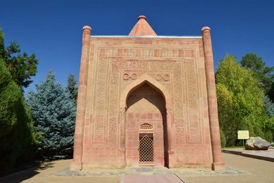
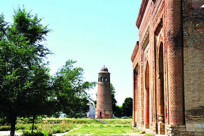 Uzgen is another ancient city that beautifies Kyrgyzstan. There was an alcazar built on the Silk Road, on the way from China to the east Mediterranean. In the twelfth century Uzgen strengthened its position and became a capital of the West Karakhanid state. Before, there was a customs house of Ilek Khan Nasr, the Karakhanid Prince, the ruler of Fergana inheritance. It was city with interesting narrow streets, bazaar areas, caravan barns and bathhouses, called hamam. In the city there were also madrasas and mosques. Now what is left of this ancient city are just the minaret and three mausoleums that are the best examples of Central Asian architecture. The most ancient mausoleum dates back to the eleventh century and is decorated by brick and carvings, and has two portal sites. The northern mausoleum was built in 1152-53, while southern in 1186-87. Both of them are decorated with columns, arcs and ornaments.
Karadaria city
The city of Kara-Daria is located between Uzgen and Kara-Kuldja and dates back to third and fourth centuries B.C. It is one of the lone survivor examples of culture of the Kushan empire.
Shorobashat
Shorobashat is located between Uzgen and Jalal-Abad, and back in the fourth and fifth centuries was known as religious and military center of Fergana. Shorobashat is situated near river Yassa and consist of citadel, religious complex, camps and shelter.
Jalal-Abad
 There are many towns and villages with the name Jalal-Abad. For example there are three of them in Afghanistan, 4 in India and Pakistan, 19 Jalal-Abads in Iran and only one in Kyrgyzstan.
The city is located at the foot of Ayub Bulak mountain, and its main artery is the Kugart river, and the right tributary of the Karadarya, which flows near the city. The city is located in an area with warm climate. Proper watering of local fields leads to rich harvest.
Jalal-Abad, as well as Bishkek and Osh, is situated on the Great Silk Road. At first it was just a village at the springs, but over time it grew up, attracted more and more people and trade started to grow. In the ninteenth century the Kokands built a fortress here, and developed trade, agriculture, and even crafts. In 1870 Russian immigrants came here and a military hospital was opened. In 1876, Jalal-Abad, being under the Kokand district of Ferghana region of the Russian Empire, received status of city.
Jalal-Abad is famous for its mineral springs, around which the initial small village of Jalal-Abad was founded. The healing features of the springs were acknowledged by Kokands, and later by Russian explorers and travelers. In the Soviet period, Jalal-Abad was considered an all-Union health resort, famous for its mineral waters and mud baths.
Arslanbob
 Arslanbob is a unique walnut-fruit forest in Jalal-Abad region, which is the largest walnut forest in the world. Every year in the forest 1,500 tons of nuts, 5,000 tons of apples, pistachio and cherry plums are harvested. People are very protective of this gift of nature. The forest has been declared a nature reserve.
Kyrgyz in this regard has a legend – this is where Alexander the Great, returning from a hike to the east, captured nutritious fruit, which later became known as walnuts.
Saimaluu Tash
 Saimaluu Tash is a stone gallery with a lot of Bronze Age petroglyphs that covers dozens of hectares of land in 30 km from the village Kazarman in Kok-Art mountains. These rock carvings are called petroglyphs and relate to Bronze Age (2000 years B.C). They represent a perfect description of the life and hunting of warriors and peaceful life of ancient tribes inhabiting this region. It is particularly noteworthy that some petroglyphs are strongly reminiscent of modern bikes and even astronauts.
Also not far from Kazarman village, there is fort preserved from fifth to seventh centuries – the monument of Saks and Usuns surrounded by 5-meter high mounds of graves.
Sary-Chelek
 Lake Sary-Chelek was formed many centuries ago as a result of landslide, and has managed to acquire not only the nut forests around, but also mysterious legends. Because of its unique nature, it was announced as a reserve back in 1959, so that flora and fauna was kept pristine. In Sary-Chelek park, deer, bears, lynx and even snow leopards can be found. Hunting is prohibited. On the northern slopes of the protected territory are areas of permafrost and alpine lakes. Sary-Chelek lake is quite big – 765 meters long and from 350-1500 meters in width. The depth of lake is the second in Kyrgyzstan, as much as 234 meters. The lake is insanely beautiful and attracts visitors with its jade depths.
The name of the lake is literally translated as “yellow bucket”. According to legend, the lake was named by a beekeeper who compared the surface of the lake, which reflects the golden autumn woods, like a bucket full of honey.
Batken
 Batken was formed in April 1934 (when it was just a village), and in 1999, the three Western Districts of Osh region formed the Batken region, and Batken became the administrative center. In this regard, in 2000 it received the status of a city.
In the Middle Ages this area was full of flowering and rich cities, and through this fertile valley ran trade routes to Kokand, Samarkand, Bukhara, Khiva and Kashgar and other famous cities of the East. Still, in its territory remained several ancient cities. The modern Batken has another type of wealth – natural. The mountains are rich with mineral springs, and the landscape makes them ideal for the development of mountaineering.
“Dugaba”
 Climbers who decide to conquer the mountains of Batken will like the base “Dugaba”, located in the valley of the eponymous river. The base meets all international standards, and in their spare time climbers can enjoy nature: the base is framed by pine forests and alpine meadows that extend to the perpetual snows are located above.
Aigul
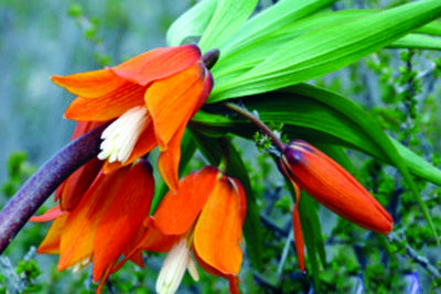 The main symbol of Batken, excluding delicious apricots, is Aigul flower – this is the Kyrgyz name of the flower grouse-eduardo. The main feature of the flower is that it always grows on the shaded side of the mountain Aygultash, and reaches a length of one meter. Its red-and-yellow petals are shaped like a bell, and in April, when Aigul blooms (according to local residents, it blooms only during the full moon) – Batken celebrates the flower festival.
A